Tuesday, 19 August 2014

Tapotupotu - New Zealand's Most Northern Campsite...

 This is Tapotupotu Bay... the most beautiful place...

 The turnoff is 7km south of Cape Reinga... The gravel road
winds down the hill to a well kept but basic Department of
Conservation campsite... Toilets and cold water.

 The beach is lovely, the sea amazing but dangerous...
Drownings have occurred so need to be careful...

 At the south end of the beach the sea feeds a small estuary.
We stopped here on our way home...

 To walk along the newly built board walk...

 And have a look at the recently installed footbridge.

 Tapotupotu beach and the surrounding hills are part of the 
coastal walkway. With this bridge over the estuary the whole
walkway is now accessible in all weathers and at all tides.

I have been here several times but I always fall in love with
with the place... Again! I will look forward to spending time
there again when I am in the Far North with my bus... 
Well stocked up with food and fishing gear and buckets
of mosquito repellent.  No cell phone reception though...
Good or bad - depending on your viewpoint and needs.

Monday, 18 August 2014

The Last 21km Of the Far North...

With everybody sorted out and breakfast over we set off on the last
21km of sealed road to the Cape... It was a very blue clear day...

Not far along the road we caught sight of the Te Paki sand dunes...
In the distance over the hills...

They came closer the further north we went... The dunes rise to 140
meters above sea level, have been pushed 5 kilometers inland and are
 wonderfully sculpted by the powerful westerly winds that blow off 
the Tasman Sea. They are accessible from the Te Paki
Stream and an amazing place for sand surfing.
Here, they are nearly to the coast...

And at the foot of them is the Te Werahi wetlands area...
A large freshwater wetlands system, which has three raupo
swamps linked by narrow sandy streams.

Further along the road our first glimpse of Te Werahi Beach and
Cape Maria van Diemen, the westernmost point of the
North Island of New Zealand.
This northern most tip of the Te Aupouri Peninsula from Cape
Maria van Diemen in the west to to North Cape in the
east... The Maori's call this piece of land Te Hiku o te Ika
(The tail of the fish) from the legend that tells how a giant fish 
(the North Island) was pulled from the sea by Maui
while he sat in his canoe (the South Island). Geology. however,
has a different tale. The rocks compromising the uplands in 
the Cape Reinga-North Cape region were formed by marine
volcanoes and sediment about 60 million years ago and 
later overlaid by marine deposits. Between 2 and 5 million
years ago, they formed an island separated from the mainland by
a shallow sea containing other small upthrusted islands. Then
about a million years ago, sand, moved northward by the submarine 
currents along the coasts of the North Island, built up into long
sandspits (tombolos) joining the islands together and
to the region around the town of Kaitaia.

Motuopao Island... Lying 200 meters offshore from Cape Maria
van Diemen is a nature reserve, home to breeding colonies of
fairy prion, white-faced storm petrel and black-winded petrel.
With rodent control it is also home to endangered lizards and
invertebrate animals... Access is restricted to special permit.

The entrance to the walk to the Cape Reinga lighthouse...

And there's the lighthouse in all its isolated splendour...
Visited by millions of people from all round the world.

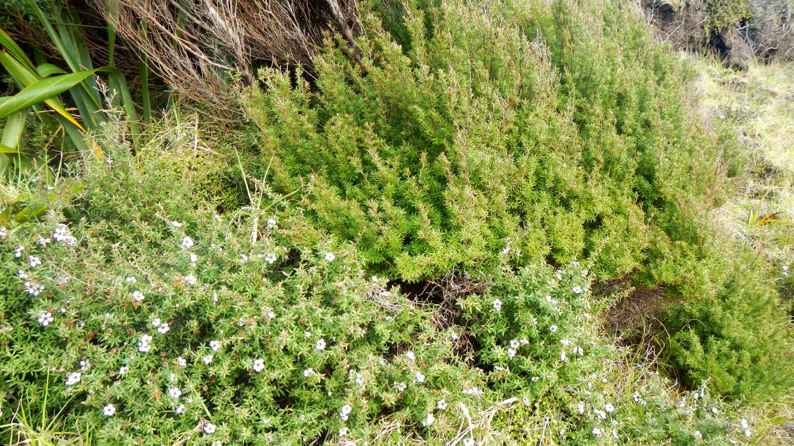
On the walk, in this sheltered spot we found some good
specimans of Manuka and Kanuka

 
Manuka (Leptospermum scoparium),with it's lovely flowers that
give us delicious honey, and prickly leaves on the left, 
a bushy shrub seldom more than 12-15 feet high... 
And Kanuka (Leptospermum ericoides)
with its softer feathery foliage on the right, that grows into
a small tree up to 40 or more feet high.

The lighthouse... Formerly on Motuopao Island
originally had a 1000watt light bulb, magnified by the lens 
system and threw a signal of warning 49kilometers out to sea.

In April 2000, the original light and associated equipment was removed 
and replaced with a modern rotating beacon illuminated by a 
50 watt tungsten halogen bulb. The power for the new light is 
supplied from battery banks charged by solar panels.

The light is monitored remotely from Maritime New Zealand’s Wellington office.

At the end of the walk by the lighthouse is this information
board telling the story of the meeting of the Tasman Sea and
the Pacific Ocean. Actually the water disturbance is caused
by the Columbia Bank... But in wild weather the sea does
produce huge waves as the two seas meet.

This is the rock to the right of the base of the lighthouse
where... Maori Legend would tell us... 

"It is here that after death, all Māori spirits travel up the coast and over 
the wind-swept vista to the pohutukawa tree on the headland of 
Te Rerenga Wairua.  They descend into the underworld (reinga) 
by sliding down a root into the sea below. The spirits then travel
 underwater to the Three Kings Islands where they climb out onto 
Ohaua, the highest point of the islands and bid their last farewell
 before returning to the land of their ancestors, Hawaiiki-A-Nui."


And looking east to North Cape which is 24kilometers away and
is the most north-eastern tip of NewZealand.
Look at this map for a distance comparison.
Because of it's rare plant and animal life it has been declared
a scientific reserve.

This whole area is a fantastic place to visit, DoC camping
grounds, coastal walks, huge sand dunes and lots of  history. For
me an absolutely must go and do place where I can spend a lot of time.


Friday, 15 August 2014

Te Paki... Northern-Most New Zealand

 I went with a group of friends to stay here... At Te Paki...
In this house owned by the Department of Conservation for it's
workers and rangers. My friends work for DoC so for a small
payment we were able to stay here. It's about 21km south of
Cape Reinga... We got there, lit the fire and settled
in for the night.

 The surrounding countryside is so green... It rains a lot that's why!

 The next morning I went for a walk while waiting for my
friends to do their 'family' thing with a small child.

 I just wandered along the road... Now a lovely sealed road.
It was only in 2010 that the last 21km of State Highway 1...
The last 21km before Cape Reinga was sealed. Before that
it was a narrow, rutted, pot holey, gravel road that produced
clouds of enveloping dust... You can now drive 2022km north
to south... All sealed.

 
 Spring seemed to be in the air... The gamboling lambs...

 I walked to this stream and the tall leaning Kanuka trees...
A tree endemic to New Zealand that can grow to 30 meters tall.

 It was lovely just dawdling along in the cool early morning sun.

Then it was home for breakfast and onto other places...
The Cape... Te Paki sandhills... Tapotupotu Bay...

Te Paki straddles the northern most tip of the north island
of New Zealand, on the small narrow Te Aupouri Peninsula.
It is one of the most intact and diverse ecosystems in New Zealand.
It extends from coastal dunes and wetlands through extensive shrubland
to tall forest. Te Paki provides habitats for a wide range of native 
plants and animals, all moulded together to form a unique and
dynamic area... Now 23,000 hectares in all.

It consists of the Te Paki Station bought by the Crown in 1966
but was originally a wedding gift made by Maori to Sam Yates
and his new bride, Maori chieftaness Ngawini... Read
the history here... It's fascinating...
The crown bought the Mokaikai Block in 1973 and a number
of dunes which adjoin the Te Paki stream in 1983. This
whole area is set aside by the Government for permanent reserves.
Managed together with North Cape, a scientific reserve and Motuopao
Island, a nature reserve, this whole area is known as Te Paki Farm Park,
managed by the Department of Conservation whose objectives
are to provide recreational opportunities and to protect
both the natural and cultural environment...

It's a  great area of New Zealand to visit.


Tuesday, 12 August 2014

Hello From Te Rerengawairua - Or Cape Reinga...


 Hello from not quite the northern most point in New Zealand.
It's a sunny but cool and windy day... Warm clothes needed.

 The familiar lighthouse and signpost... I wonder how
many millions of photos have been taken here!

 
 The Pandora Bank - although in an information book it's
called the Columbia Bank... so at this point I'm not sure.

Anyway it's a fabulous place to visit. I've
 been here many times and depending on the weather
it's always different and always a source of fascination.

Saturday, 9 August 2014

The Far North of New Zealand... Cable Bay...

 Yesterday I went to Cable Bay. Looking across the water
of Doubtless Bay... The little blimp in the middle is Mt Puheke...
 
 Tokerau Beach on the  far side...

 And looking south along to Coopers Beach...

 The golden sand...

 Across the water to the little settlement of HeiHei...

 The coloured broken shells... Hundreds of them...

 The swirling water...

 Incredibly clear rock pools...

 And the sprawling Pohutukawa trees...
This beach the sand and views epitomizes The Far
North to me...
 
The houses developing on the hill in the north facing sun.
I still think this area of New Zealand is my favourite
place... I could live here... I will bring my bus back again
when the weather's warm enough to fish and swim.
 

Friday, 8 August 2014

Flying North... A Holiday For Me...

 Well... I have flown off to supposedly warmer climes...To have 
a holiday for a month, visit friends and do nothing much
but look after ME! and recover from looking after Dad
and to give some attention to my leg which was broken
and is recovering but needs a visit to my Dr up here and
some physio and massage to find out what is going on.
This is Christchurch as I left... Cold, brilliant sun and the
magnificent mountains covered in snow.

 From the air looking back over Christchurch to the south east
the houses, New Brighton and Sumner on the hills...

 The Waimakariri River... A big shingle braided river...

 The river mouth... Good fishing I wonder...

 We left the coast behind...

 Snow over the mountain tips...

 Then we reached Auckland... Cloudy, grey...

 The Waitemata Harbour... Rangitoto Island at the back left...

 Some of the huge sprawl of houses...

And the Auckland runway... Grey and raining.
I had a wait then flew to Kaitaia which was
also windy and raining.
I'm still waiting for some of the Far North
hotter weather.