Wednesday, 24 February 2016

Bruce Bay... An Icon of the West Coast...

Bruce Bay... But the beach is Maori Beach. I stopped here for morning coffee. A beautiful day.
I could have stayed a week or more... But I didn't.

On the other side of the road the wild flaxes and bushes. You can see the effect of the prevailing 
wind from the west.

At the north end there is an overnight parking area... I have already decided I will be exploring the West Coast again. Too much to see and not enough time...

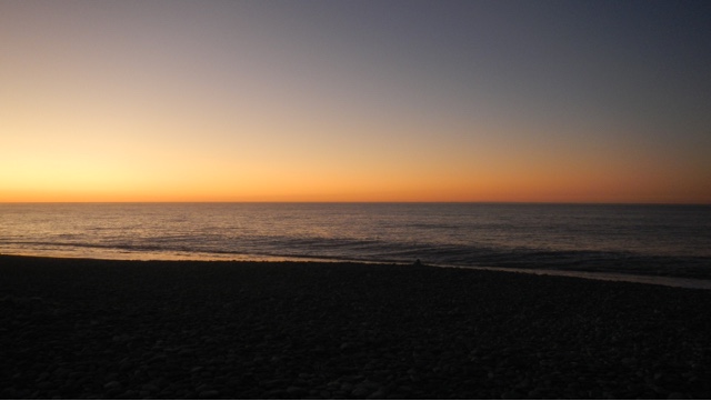
Out there somewhere... Is Australia...

Oh well... Moving on...

Over the Mahitahi River...

To... Well I don't know yet!

Gillespies Beach

From Franz Joseph I walked round Lake Matheson, not a very good day with a bit of wind so the reflections were poor and I'm sure you have seen zillions of photos of that lake. On the drive there very good views of Fox Glacier.
Next stop was Gillespies Beach. It's about 16km west from Lake Matheson. The road description is not good so I enquired at Doc then off I went. It's hard dirt, narrow, windy, absolutely beautiful bush right to the side of the road and passing wasn't impossible. There is a Doc camp right by the beach, big vehicles in the car park and plenty of grass areas for tents. I got there by late lunch time, a few others there but by early evening it was packed and standing room only.
It's another amazing place...


A stunning beach. A few brave souls were swimming. I tried fishing but the waves just tossed my line back in.

This is the back side of Mt Cook on the right and Mt Tasman on the left. The GPS told me they are 21km away.
It was a surreal feeling standing on the hot stony beach, blue sea on one side, snow covered mountains on the other.

Along with lots of others I sat on the beach and watched the sun set into the sea...


The last rays of sun on the mountains.

Sunday, 21 February 2016

Lake Ianthe... And a Salmon!

This is Lake Ianthe, quite a small lake not far south of Hokitika.

The parking, although a DoC camp is a tiny area just off the road. Only parking for about four vehicles.
I was feeling a bit stressed when I got there late in the day. The day had been busy and a bit rushed...

So what better relaxing therapy than fishing. There was a small jetty so that's where I spent the evening as it got dark looking at this beautiful view and darkening sky.
I was feeling better and it was nearly dark... And snap... Definitely a fish. It didn't fight much and as it's the first fresh water fish I have caught - finally! I had no idea what to expect.
It was easy to put my net underneath it and lift it out...

I had no idea what it was... It had to be a trout or a salmon of course... I cut off it's head and tail and gutted it. The skin produced an amazing amount of slime... It got washed and onto a plate in the fridge to be investigated more in the morning...

It turned out to be a sea run salmon... Just look at the colour of it.

I smoked it and here it is ready to eat... So fresh and yummy. 
I want to go back there and catch another one of course! I've been fishing in lots of rivers and lakes...
But so far this is my only fish.

Wednesday, 17 February 2016

Hokitika Gorge...

This place is an absolute must go there place. The day we went it was pouring with rain.  There is only a small car park so big vehicles were difficult and the torrential rain made it worse... But it's spectacular...

All my wet weather gear on...

Not very far round the track till the first glimpse of this stunning water and gorge.


The water is an intense blue... Ingredients are rock flour, melted glacier ice, river water.  The rock flour is made by grinding down schist and greywacke rock into fine particles. Combine rock flour with a dash of melted ice and minerals from ancient glaciers. Continuously add to river water. The result is a gorgeous milky, turquoise coloured river.


A lot of rain was falling the day we were there but it creates this beautiful bush and very unique 'West Coast'.

The track took us to this lookout then down onto this small beach...


The white spots are rain drops... It was so hard to keep my camera dry... Impossible really.

The Hokitika River is 64km long starting in the Southern Alps. It emerges from this gorge merges with the Whitcombe River and flows into the Tasman Sea just south of Hokitika.

This walk is the top rated walk in Hokitika on Trip Advisor...

Lake Kanerie

Although I am no longer exploring the West Coast I have to show you a few more of my favourite places. 
I had been looking forward to the West Coast beaches and sunsets but I was surprised by all the beautiful lakes.
This is Lake Kanerie in the Hoklitika area...

The early morning mists...

And reflections... Perfectly still before the day really starts and the wind comes up...

This lake is 30km southeast of Hokitika, drains into the Tasman Sea via the Kaniere and Hokitika Rivers. It has a surface area of 22km and is 2nd only to Lake Brunner in size. It is popular for boating, fishing, picnicking and water skiing although at this perfect time of the morning, nothing was happening... So peaceful...

There is a very nice DoC camping area, elevated in terraces above the lake. It's very popular. 
This track goes to the toilet block and lake edge...

Native Toetoe with their feathery plumed flowers... I was brave and had my first West Coast swim here!

Saturday, 30 January 2016

Beautiful Franz Josef Glacier...

Today was a lovely fine day. It has finally stopped raining after about two weeks of rain with a few fine hours here and there. It was wonderful to be out and about not bundled up in my leggings and raincoat. I took the opportunity to walk to the Franz Joseph Glacier while the day was clear to see the top of it and the floods from all the rain have receded and the track is open...

This notice is at the beginning of the track and the photo below is right beside it. The walk is about 4km return which means the glacier has retreated 2km since 1867...


The first part is a very well formed track... And not far before the first glimpse of the glacier...


The stony riverbed of the Waiho River which is fed from the melting glacier and all the waterfalls and the rain of course!  This notice made me laugh... Who would want to go swimming here?

Amazing waterfalls gushing down the Rocky Mountain sides...


Enormous piles of rocks and stones left behind by the retreating glacier...


There is so little of the glacier left to see from the view point at the end of the track. Where I am standing is 300m high. The glacier goes another 9km and rises to 2800m. You could only see 
this from a helicopter. 
The blue ice in the middle in the front is an ice cave...

Here it is close up... With binoculars I could see the foam and spray inside the cave from the river that is rushing down the crevasse.. It's all very stunning and geographically amazing...